Maps Focus History Lesson for Students
How can maps helps us learn about Iowa history? That’s the question students in 7, 8 and 9 year olds at the Downtown School were trying to answer. The question arose during Mrs. Allen’s and Mrs. Buckner’s Learning Group’s study of rocks.
Experts from the DNR came to share how rocks can help tell the history of the Earth. This led the experts into a presentation on landforms in which they brought elevation maps of Iowa. After processing through this information, a new investigation presented itself. Students realized these maps show the history of Iowa from thousands of years ago by understanding the landforms and elevations, so what else could maps tell us?
With that, students determined what they needed to know in order to answer the question. Before they could use a map to learn history, they had to learn how to read a map!
The classes spent time learning the different parts of maps and their uses; and explored various types of maps and how to read them. After that ground work, the students were ready to start exploring Iowa Maps, drawing conclusions, brainstorming questions and researching. All of the students spent many hours gathering information from maps, websites and books. They used the links and maps Mrs. Allen and Mrs. Buckner had placed in their Edmodo project folders to gather their information.
When it was time to represent, the classes had a discussion on what way would be best. Deciding that every student recreating a map wasn’t going to show all they have learned, with the help of their teachers, they explored electronic options.
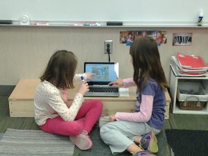
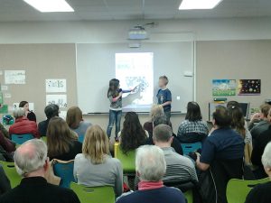
Using the new revolves, students used a website to create a glog or interactive poster. They were able to include several maps that summed up their learning as well as photographs and diagrams. Once completed, Mrs. Allen’s and Mrs. Buckner’s Learning Groups shared their learning and hard work with families and community members using the interactive features on the projector in the library.
Throughout the project, students were very engaged in their learning. All of the students not only learned about their topic but were also discussing their learning with others at lunch, recess and any other time.
Using maps was a visual way to help younger students discover, question and learn about history. From there they were able to find, with teacher guidance, and read texts or websites to gather information. This way proved to be engaging and help students build a basic understanding of Iowa history.


